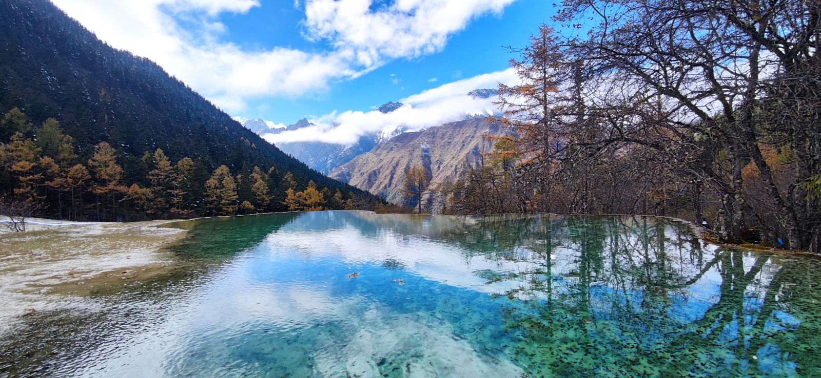
Chinese Name: 黄龙国家级风景名胜区 Pronunciation: Huánglóng Guójiājí Fēngjǐng Míngshèngqū
Suggested Visiting Hours: 1 Day
Peak Altitude: About 5,588 meters
Occupied Area: 400 square kilometers
Address: Songpan County, Aba Tibetan and Qiang Autonomous Prefecture, Sichuan Province, China
| Visitors | Ticket Price | |
| Peak Season (June 1 to December 15) |
Shoulder Season (December 16 to May 31) |
|
| Adults | 170 yuan | 60 yuan |
| Children (above 1.2 meters) |
85 yuan | 30 yuan |
| Teenagers (7-18 years old ) |
||
| Seniors ( 60-64 on national statutory holidays) |
||
1. Children under 6 years old (included) and below 1.2 meters(included) are free of charge for the admission fee and cable car fee;
2. Senior citizens over 65 years old (with ID card) are free of charge;
3. Senior citizens between 60 to 64 are free of charge on non-national statutory holidays;
4. The above policy(2-4) is only applicable to the admission fee.
| Contents | Price |
| Hongyanguan Sightseeing Cable Car | 80 yuan (up-way) |
| 40 yuan (down-way) | |
| Munigou Valley Scenic Spot | 100 yuan |
| Time | Opening Hours |
| Peak Season (June 1 to December 15) |
8:00 - 17:00 |
| Shoulder Season (December 16 to May 31) |
8:00 - 16:30 |
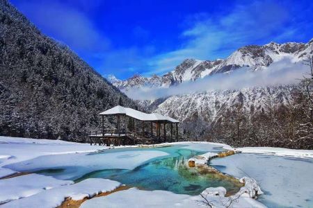
Huanglong Scenic and Historic Interest Area (hereafter as Huanglong Scenic Area) is located in Songpan County, Aba Tibetan and Qiang Autonomous Prefecture, Sichuan Province. It has an area of 700 square kilometers. It is the only well-protected plateau wetland in China, 100 kilometers away from Jiuzhaigou Valley and 1,700 to 5,588 meters above sea level.
Huanglong Scenic Area is famous for its “four peculiarities”--colored ponds, snow-capped mountains, canyons, and forests, together with the beautiful beach streams, ancient temples, and folk customs making the site be crowned as “seven uniques”.
Huanglong Scenic Area consists of Huanglong Valley, Danyunxia Gorge, Munigou Valley, Xuebaoding Peak, Xueshanliang (snow mountain ridge), Hongxingyan (red star cliff), Sigou Valley, and other scenic spots. The main landscape is in Huanglong Valley, which is about 3.6 kilometers long, with travertine deposits all over it.
The latitude range of the Huanglong Scenic Area is 1,700-5,588 meters above sea level. Generally, the relative height difference between peaks and valleys is more than one thousand meters. Most of the landform above 3,700-4,000 meters are ice-eroded landform, which are majestic and imposing.
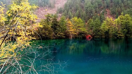
Huanglong Scenic Area is rich in the karst gorge which has steep cliffs, abundant water sources, and luxuriant vegetation. The animal habitats in the area can be roughly divided into 8 types. A total of 221 species of vertebrates and 156 species of birds have been found here. According to some statistics, there are 1,300 species of plants in the scenic area with the characteristics of mixed species of the north and the south of China.
The terrace-shaped spots are well-known in the world for their rich animal and plant resources. Despite the fabulous alpine landscape, you can also discover various forest ecosystems, as well as limestone structures, waterfalls, and hot springs. Many endangered animals’ habitat in this area, including giant pandas and Sichuan golden monkeys.
Huanglong Scenic Area, dominated by large-scale, ingenious structure, and colorful surface travertine landscapes, is famous at home and abroad for its rare karst landform, which can be called a fairyland on earth. It was listed as the “Best Scenic Spot” on October 9, 2016, by the National Tourism Administration.
It is crowned as a “World Natural Heritage”, “Man and Biosphere Reserve in the World”, a National AAAAA-level tourist attraction, a National Key Scenic Spot, and has a “Green Global 21” certificate.
Huanglonggou Valley, the main scenic spot, resembles the image of “dragon” in the minds of Chinese people, and has always been hailed as “Jade Lake on Earth” and “Symbol of China”. It is more respected by villagers of all ethnic groups in the local area. Tibetans call it “Dongri Seerjun”, which means Conch Mountain in the East (referring to Xuebaoding Peak) and Golden Haizi (referring to Huanglonggou Valley).
In October 1982, Huanglong Scenic Area was approved as a National Key Scenic Spot by the State Council of the People’s Republic of China.
In December 1992, Huanglong Scenic Area was officially included in the “World Heritage List” by UNESCO as a Natural Heritage.
In 1997, Huanglong Scenic Area was listed as the International Man and Biosphere Reserve by the United Nations.
In February 2001, Huanglong Scenic Area obtained the “Green Global 21” certificate, and it has become a world-class scenic spot with three laurels.
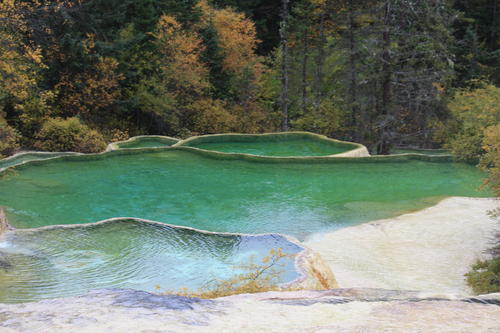
When you enter Huanglong Scenic Area, the first thing you will see is a group of ponds stacking one after another, collectively named Yingbin Pond (greeting pond). Yingbin Pond has various shapes. The water in the pond is very clear and surrounded by mountains.
A legendary cave named Bathing Cave is the source of ancient glaciers. The cave is 1 meter high and 1.5 meters wide, and is covered with light yellow and oyster white stalactites near the entrance. The place at the entrance is filled with smoke, which is said to be the place where the immortals take baths. Legend has it that barren women can become pregnant after washing their bodies here. This legend adds some mystery to the scenic spots.
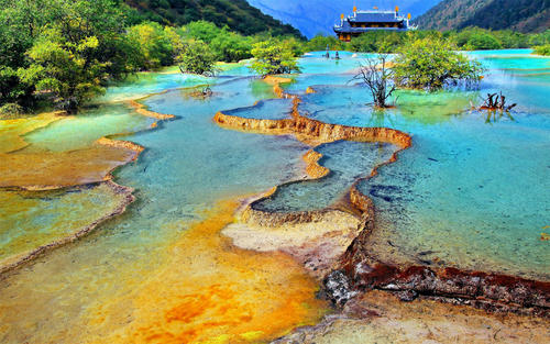
Five Colored Pond is 3,576 meters above sea level, its area is 21,000 square meters, and there are 693 small ponds in total. It is the largest group of color ponds in Huanglonggou Valley, and it is also the largest and highest outdoor travertine color pond in the world today.
The color ponds are low and scattered, and the water in the pond overflows. Under the sunlight, they are white, purple, blue, and green in different shades, and the colors are extremely shining and beautiful. Due to the various changes of light, a “multicolored scene” is formed, which has become a beautiful landscape in Huanglong Scenic Spot.
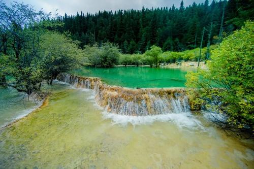
Huanglonggou Valley has a mountainous cave, in which the largest travertine cave is called “Huanglong Cave”, also known as “Guizhen Cave” and “Foye Cave”, with an altitude of 3,568 meters.
Located about 10 meters to the left of Huanglong Housi Temple, there is a visiting hall at the location of ten meters after going into the cave. It is 30 meters high, 20 meters wide, and 50 meters long. The spot covers an area of 1,000 square meters. But, so far, the depth of the cave cannot be verified.
Every winter, the ice forest, ice bamboo shoots, ice mantle, and ice waterfall in the cave constitute a gorgeous picture of ice crystals.
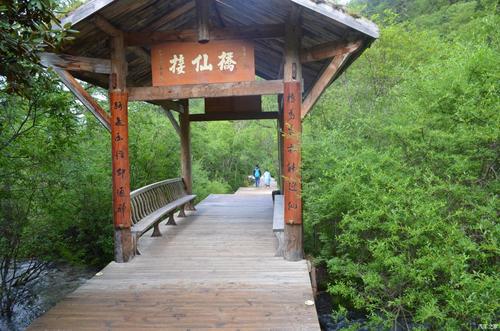
Jiexianqiao (meeting immortals) Bridge is one of the Taoist cultural sites in Huanglonggou Valley. Legend has it that a devout worshiper stepped on this bridge and heard some music from the sky. After crossing the bridge, he saw many immortals singing and dancing by the side of a colored pond. In the colorful clouds, the immortals welcomed him into the Jade Lake Wonderland.
And according to the poem “Song of the Yellow Dragon”, Jiexianqiao Bridge is the place that connects the immortal bridge to the world of mortals and the fairyland. Therefore, the place has a mystical sense which attracts many tourists to visit.
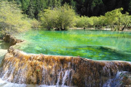
Bonsai Shoal covers an area of 20,000 square meters, with more than 330 color ponds, with an altitude of 3,320 meters, and the upper part is 418 meters from the mirror reflection pool.
Bonsai Shoal is called the “Golden Sand Pavement”, which is composed of hundreds of ponds. Beside the bonsai pond, there are a lot of flowers, trees, and strange rocks, and the gorgeousness of the landscape would make professional garden designers stunned. If it were not for God, this kind of beauty would never be created.
The bottom of the ponds is yellow, white, brown, and gray. The surface of the pond is clean and dust-free, looking like a mirror. In the ponds, there are woods, stones, grass, cypress roots, mountain flowers, and colorful wild fruits. This splendid landscape, like a peculiar bonsai created in the sky, make the gardeners amazed.
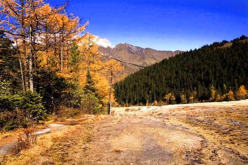
Jin Sha Pu Di is 3,305 meters above sea level, about 1,300 meters long and 40 to 122 meters wide. According to scientists, Jin Sha Pu Di is the surface travertine stream with the best physiognomy and has the largest area, longest distance, and the most beautiful color among similar geological structures discovered in the world.
It is one of the three largest in the Huanglong world. Because the carbonate has lost the geographical conditions for forming a pond, the flooding waves flew over a 1.3-meter-long ridged slope and condensed layers of golden travertine beaches under the water. It looks like a piece of “scaly armor”, shining golden light in the sun. It is another rare spectacle of Huanglong.
In the world-famous Hengduan Mountains, the Minjiang River, the Dadu River, the Yalong River, the Jinsha River, and other large rivers flow from north to south. Most of them are located in Sichuan Province on the eastern edge of the Qinghai-Tibet Plateau. The elevation is mostly 2,000-3,500 meters. Numerous river valleys and mountains are especially suitable for nomadism, forming a natural nomadic corridor in the west of China. In this nomadic corridor, the great migration of Qiang people, which is rare in history, took place.
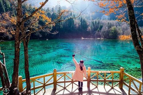
Due to the differences between the two civilizations, since the Han Dynasty (202 BC-220 AD), the inland farming peoples have been in constant conflicts with the nomadic communities in the west. In order to prevent the nomadic tribes in the west from harassment, the inland farming peoples established a defense line from Gannan to the high mountains in western Sichuan to prevent the nomadic people from advancing eastward. The Minjiang River has become a geographic and strategic barrier between the nomadic corridor and the agricultural cultural zone.
As the level of social development of Chinese tribes’ farming civilization continues to surpass that of nomadic tribes, the confrontation between the two civilizations began in the Spring and Autumn Period and the Warring States Period (770 BC-221 BC) and reached its peak in the Tang Dynasty (618-907).
The differences between the two civilizations have been revealed. Since the Tang Dynasty, although the Tibetan forces have risen and continued to push the Central Plains and once occupied Chang’an, it has been difficult to make further progress in the face of more advanced farming civilization.
Since the Han Dynasty, the agriculture in central Shu has developed and the military has been strong. Although the Tibetans once sent 200,000 troops to Kusong Prefecture to occupy Qionglai, they failed to occupy the Chengdu Plain.
Jin and Yuan’s cavalry went from south to North China and Jianghan(southern and central Hubei province), but they never entered Shu(Sichuan province). This nomadic corridor served as a barrier between the Tibetans and the political forces of the Central Plains dynasties.
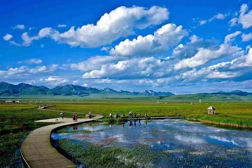
Until 1253, the northern nomadic leader Yuan Shizu Kublai personally led his army to choose the pastoral areas in western and southern Sichuan and went south along the Yalong River.
At the end of this corridor, he crossed the Jinsha River to Lijiang, Yunnan, and destroyed the Dali Kingdom. Because the Central Plains did not understand this nomadic corridor, the Song Dynasty was restrained. There was no strong civilization enough to block the passage chosen by the Qiang people in the northwest.
In this corridor, a great ethnic migration, dominated by Qiang people, took place. A group of Qiang people migrating to the east entered the Minjiang River Valley. The Qiang people in Wenchuan, Maoxian, and Songpan of Aba Prefecture in Sichuan are the only ones currently preserved. The intact western Qiang tribes are known as “living fossils of the nation.” After they defeated the Qiang people called “Goji” living in the upper reaches of the Minjiang River, they lived and worked in peace and contentment in the Minjiang River Valley and later became one of the sources of the Han people in the Central Plains.
According to ancient legends, the Yandi Shennong, the leader of the Qiang people, used stones as weapons, invented planting grains, made pottery, and did business during the daytime.
Later, he allied with the Yellow Emperor of the Central Plains. The Yellow Emperor changed the totem bear to a dragon in order to unite the tribes. At this point, the “dragon species” of the descendants of Yan and Huang has spread for five thousand years, and the Chinese nation has stood tall as a descendant of the dragon among the nations of the world. This may be the reason why the legend of Huanglong spread in Songpan, where Tibetan, Qiang, Hui, and Han peoples live (Huanglong literally means yellow dragon in Chinese).
Take the cable car at the entrance →Huanglong Main Valley →Yingbin Pond →Flying Waterfall →Bonsai Shoal → Zhengyan Pond →Huanglong Cave →Huanglong Temple →Five Colored Pond →entrance via cable car or on foot
The best time to visit Huanglong Scenic Area is from April to November when the water in the lakes is abundant and the pond stretches at its largest.
The climate in Huanglong Scenic Area belongs to the plateau temperate sub-frigid zone monsoon climate. The characteristics are: humid and cold, long winter throughout the year, short summer, and almost connected spring and autumn.
In Huanglong Scenic Area, the sunshine is abundant, morning and evening are foggy, and rainfall is mostly concentrated from May to August each year. The annual average temperature of the Huanglong Scenic Area is 5-7℃, the hottest July has an average temperature of 17℃, and the coldest January has an average temperature of 3℃. Therefore, April to November is the best time to visit Huanglong Scenic Area.
Route 1:
Take the shuttle bus at Jiuzhai Huanglong Airport (to Huanglong Scenic Area).
The shuttle bus is privately operated and has no fixed departure time. It leaves as soon as it is full (sometimes it needs to wait for a longer time). It stops at night according to the passenger flow. The shuttle bus will also stop when there are few people in the off-season. About 22 yuan for single fare and about 40 yuan for return fares.
Route 2:
Take the bus at Jiuzhaigou (to Huanglong).
There are two buses departing at 06:30 and 07:00 every day, and the ticket price is about 38 yuan.
Chinese: 请带我去黄龙国家级风景名胜区。English: Please take me to Huanglong Scenic Area.
If you go to Huanglong Scenic Area from Seercuo International Hotel, it takes about 3 minutes (about 8 yuan).
If you go to Huanglong Scenic Area from Songpan Train Station, it takes about 1 minutes (about 130 yuan).
If you take a taxi to Huanglong Scenic Area from Jiuzhai Huanglong Airport, it takes about 50 minutes (about 90 yuan).
